What is Durness Chert?
Durness Chert
One of the most common questions that we get asked on the tour is “chert? what is chert?”, or simply “what’s all this stuff?”. Well…
Chert is a sedimentary rock type composed of very fine grained quartz / silica which usually forms sharp edges when it breaks. Although people frequently refer to it as ‘flint’, this can be inaccurate from a geological perspective because flint is only one particular form of chert which forms within chalk and marls.
Although chert nodules in the form of flint are commonly found around the UK coastline, this generally only applies to areas where chalk was deposited in marine conditions during the Cretaceous Period. Preserved rocks of this age are very rare across Scotland and are largely limited to a silica mine at Lochaline, hence sources of chert are very limited across northern Scotland. Essentially, the only significant sources of chert are specific horizons within the Durness Limestone that are largely preserved in two areas: Durness and the Isle of Skye. It is therefore no coincidence that both these areas show evidence of Neolithic activity from a time when chert would have been a highly valued natural resource.
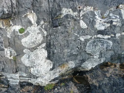
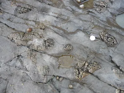
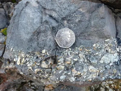
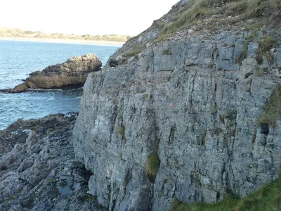
Chert within the Durness Limestone can be found in two forms; nodules and beds. Both of these are the result of a chemical replacement which has occurred within the limestones and dolostones shortly after burial (turning calcium carbonate to silicon dioxide). Individual nodules can be up to 0.5m wide although these are limited to the Sailmhor formation which is found around Smoo Cave and some sections along Balnakeil Bay / the Kyle of Durness (Streetview). The large nodules appear to have a close link with stromatolite / thrombolite growths where the algal mounds (or the spaces between them) have been preferentially ‘silicified’.
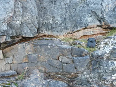
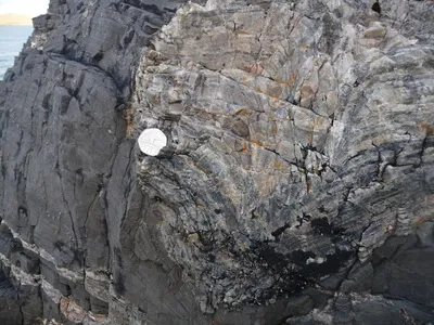
Chert beds are relatively rare although a distinctive milky-white coloured bed has formed at the boundary between the Sailmhor and Sangomore Formations, easily seen along the western cliffs of the Geodha Smoo. This can be up to a couple of metres thick and is observed everywhere the formation boundary is seen at Smoo Cave, Sangomore (beside the phone mast), Balnakeil Bay and Keoldale – an area covering several square kilometres.