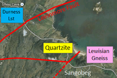
Ceannabeinne & Sangobeg
This area covers the geological section which is east of the Leirinmore Fault, i.e. moving out of the Durness Graben towards Loch Eriboll.
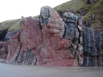
The Lewisian Gneiss (of the Caledonian Foreland) in this area has a different character to the ‘Lewisian-like’ gneisses (of the Moine Thrust Sheet) seen at Sango Bay & Faraid Head. It is best seen at Ceannabeinne Beach (two miles east of Smoo) where the banding dips vertically on the steep limb of a large regional fold structure. A large boudin structure in the shape of an hourglass can be found in the cliff at the western end of the easily accessible beach where a dark band within the gneiss was stretched to the point that it split whilst the rock was very hot and relatively soft at great depth. The Ceannabeinne area is also littered with pink-red intrusions of pegmatite which have been injected into the gneiss during the ‘Laxfordian event’ (called so because it only affected the Lewisian Gneiss north of Laxford Bridge, ~20 miles SW of Durness). The red colour comes from a high Potassium feldspar content which is frequently used in the glass and ceramics industries.
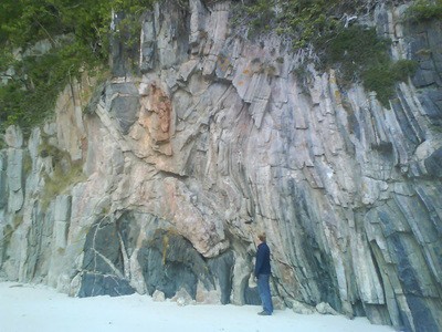
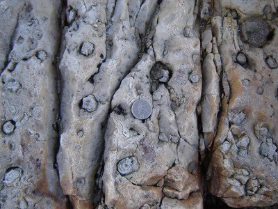
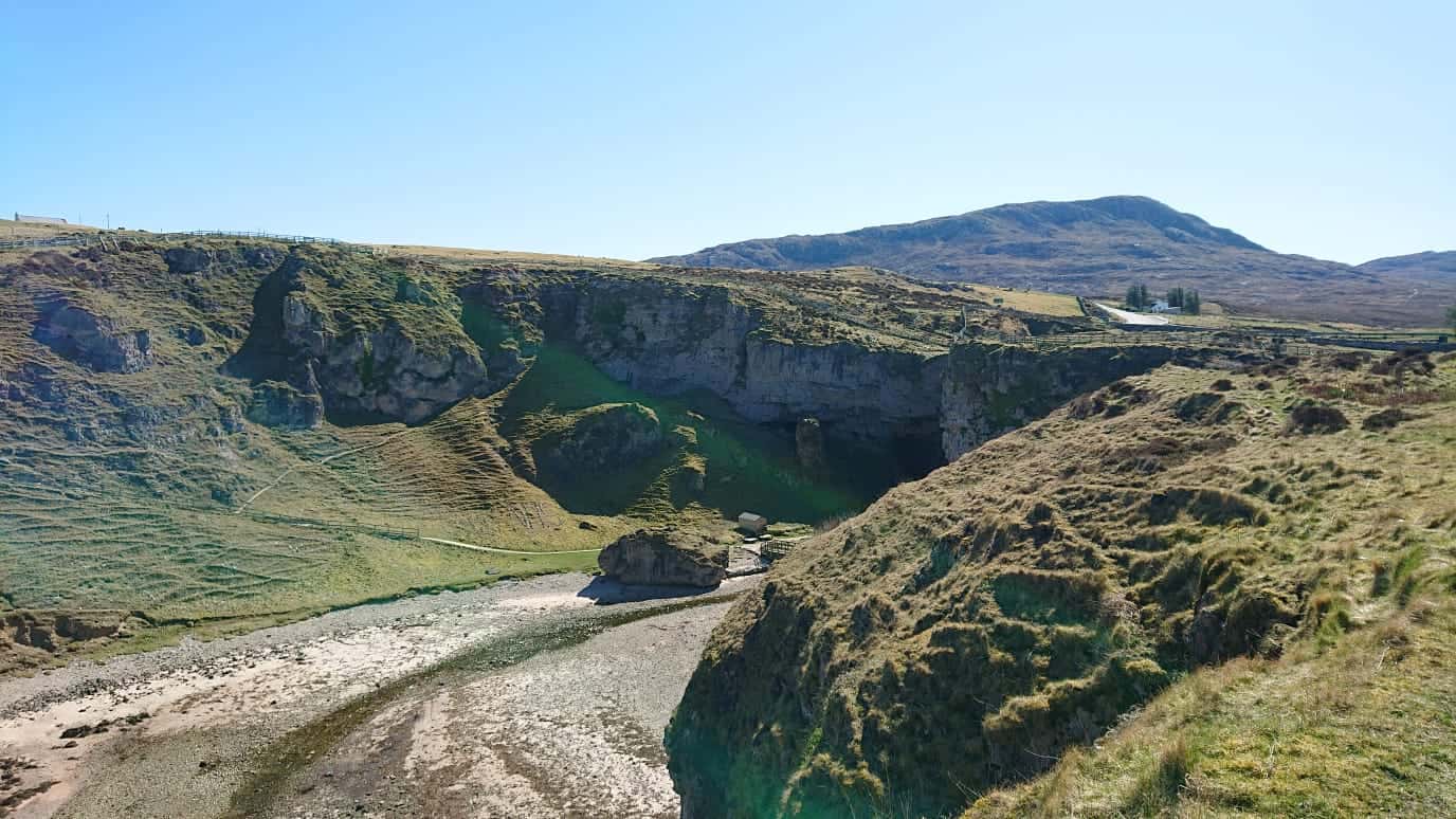
At Sangobeg, beds of the ‘Pipe Rock’ quartzite can be seen on the western side of the beach, separated from the gneiss by a fault which is now obscured by beach sands. The pipes are monocraterion / skolithos trace fossils which were created by soft-bodied creatures burrowing into soft, quartz sand at the time. Quartzite is much more abundant along the western sides of Loch Eriboll where one of the UK’s largest ‘dip-slope’ surfaces has formed along the once horizontal (now tilted) sedimentary beds. The ‘basal quartzite‘ here does not have the trace fossil pipes however. Instead, it exhibits a particular type of cross-bedding which relates to waves within a tidal zone, implying that they were deposited in slightly shallower waters than the Pipe Rock
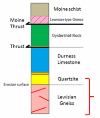
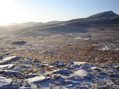
With the Loch Eriboll fjord being formed along the weak, lowermost sections of the main Moine Thrust Zone, this is an excellent place to appreciate how geology controls the landscape. To the west is the uniform dip-slope of the undeformed sedimentary sequence (i.e. the Caledonian Foreland) whereas the rugged topography to the east of the loch relates to the remainder of the thrust zone which exhibits some of the most complex geology in the British isles.