Faraid Head & Balnakeil
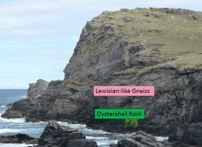
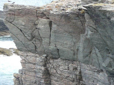
The Moine Thrust outcrops in the cliffs at the northern end of the Faraid peninsula in addition to the same rock types seen at Sango Bay (Oystershell Rock and Lewisian-like Gneiss). The contact isn’t particularly obvious however due to the rocks above and below it both formerly being gneiss but may be picked out due to the Lewisian-type gneisses containing bands which are a lighter colour than the dark green Oystershell Rock.
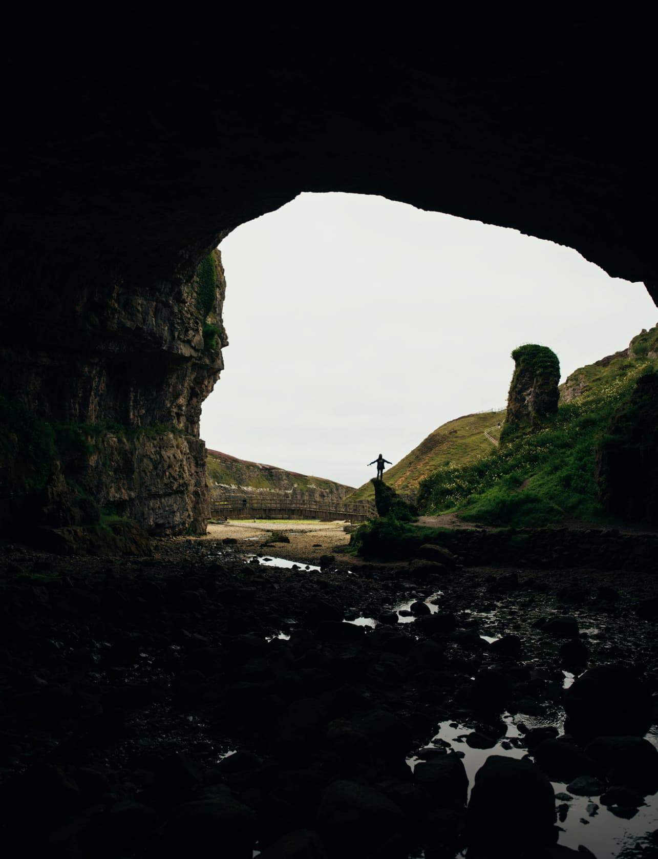
The Faraid peninsula is the only place where the Moine Schist can be seen to the west of the main (Eriboll-Skye) Moine thrust belt. This observation was of particular importance to early geologists because it indicated that the Moine Thrust Sheet must have been pushed westwards over the Caledonian Foreland for at least 13 km (the distance from Durness to the main Moine outcrops over at Loch Eriboll), giving a minimum displacement figure. Geologists generally believe that the level of deformation observed in the rocks implies that this figure is likely to be be more than 100km.
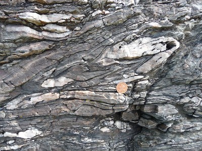
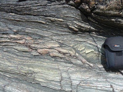
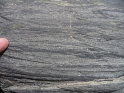
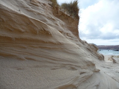
Although the Moine Schist can be seen in the cliffs all down the eastern side of the headland, the most accessible outcrops are in the low cliff section located mid-way along Balnakeil Beach. The rocks were originally sedimentary in origin but the sediments (once sands / muds) have experienced ‘low-grade metamorphism’ (i.e. some deformation but nowhere near as heavy as that seen in the Lewisian Gneiss) since being caught up in the formation of the Caledonian mountain belt. The physical appearance of the Moine Schist here isn’t fully reflective of the unit as a whole though as the rock here is still within the lower sections of the Moine Thrust Sheet which was also stretched / sheared to form a mylonite. One sea cave within it contains flowstone deposits, sourced not from the surrounding Moine rocks but from the carbonate-rich shell sands of the overlying dunes. The dune field itself is one of the largest and most impressive in the British Isles with some dunes tops being 60m above sea level.
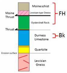
Seeing as the vast majority of visitors reach Faraid Head via Balnakeil, it is worth noting some features of the Durness Limestone there which outcrops along the shore just as you walk onto the beach from the car park (immediately west of the small stream). The dolostone and limestone rocks belong to the ‘Balnakeil Formation’ section of the sequence and are separated from the Moine rocks of the Faraid Head peninsula by a major (normal) fault which is buried beneath the beach. The northwesterly extension of this fault is reflected in the landscape on the opposite side of Balnakeil Bay at Port Odhar and Garvie Island where the low lying, greener areas of Durness Limestone are separated from the hills / cliffs of Lewisian Gneiss / Torridonian Sandstone.
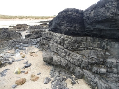
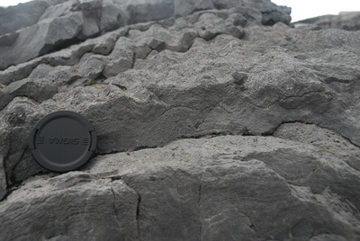
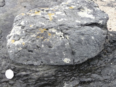
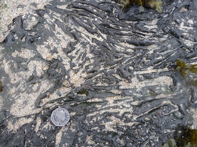
The depositional environment of the Durness Limestone here would have been dominated by algal flats which is reflected by an impressive and diverse sequence of stromatolite and thrombolite structures, similar to those seen along some coastal stretches of Australia and the Persian Gulf today. Depending on the thickness of sand on the beach, ‘flake-breccias’ can sometimes be seen too which usually represent reworking of dried out muds during ancient storm events.